Blog
Wierden
The last time I cycled the official route at Wierden it was remarkably unpleasant weather with large quantities of rain and wind making the tracks into a sort of nasty sandpaper that got everywhere. Last Sunday it could not have been more different. Blue skies, sunshine, little or no wind - a beautiful spring day. The route has also been improved in the last years by adding some extra bits in the woods. The route consists of bits of woodland with bendy singletrack connected with longish stretches of tarmac in between giving a chance for recovery and to admire the pretty traditional rural landscape. The people who made the track have been very creative, with some sections of singletrack squeezed into the middle of what is barely more than a wide hedge between roads. The recovery on the roads is not such a problem as the bits in the woodlands are designed to challenge you to cycle as fast as possible round the bends, with built-up cambers and so on. The best bit is without doubt the section just to the north of Wierden, by the 'Lageveld' recreational area, with a 4km long section of fun twisty bits as shown in the photo below. It is definitely worthwhile downloading the route as otherwise it is easy to miss the good bits. The route on the site is 31 km, but there are signs to an extra 10 km section that doesn't so far seem to have a GPS route. The reviews there are very mixed, some people are clearly a bit disappointed by all the tarmac, but I think that is a matter of expectation, if you know that is the case you can enjoy the singletrack in the woodland and in the sections on the road just sit back and enjoy the landscape.

Wildlife
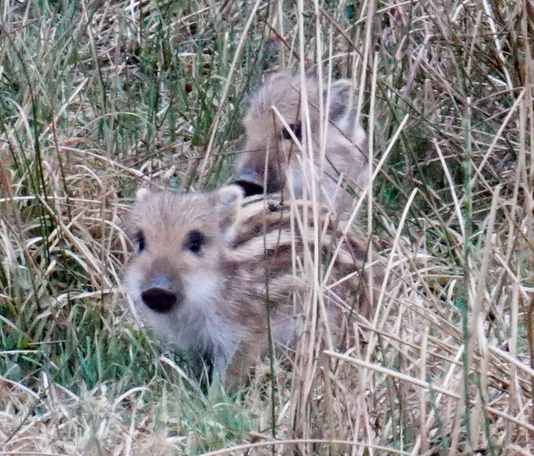
A couple of weeks ago we were visiting the North Eifel. It is only a couple of hours away, just over the border, with a very different landscape and flora from here, and great mountain biking. One of the things I always notice there is that you see much more wildlife than here. And sure enough, we were treated to the spectacle below:
A pair of young piglets, showing how well their stripes work as camouflage in amongst the rushes and grasses, came to within a few meters of us, showing no fear at all, and even more remarkably the adults in the background were not particularly bothered either.
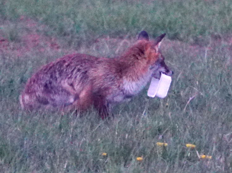
Another day at dusk we were treated to a fox snacking on a take-away just outside our cottage.
So when we got back home and I was out cycling with the club, it was natural to be talking about how we don't see so much here. But what happened, within half an hour we saw a fallow deer and two red squirrels!
Coltsfoot

Although snowdrops, daffodils and crocuses traditionally herald the beginning of spring, these days they more often start flowering when it is still thoroughly winter. The Coltsfoot (Tussilago farfara) is a real spring flower - when it is out you know that for certain it is really spring. At first glance you might mistake it for a dandelion, but the bracts running attractively up the flower stem are quite distinctive. The past couple of weeks the woods have been full of the sounds of finches, woodpeckers, greats tits and blackbirds all calling out establishing their territories, but now that the Coltsfoot is flowering I know that spring has really started. And what is that to do with mountain biking? Simply that if I was not out in the woods on my bike I would not have seen the Coltsfoot flowering, nor seen the trees coming into bud, nor heard the green woodpecker 'laughing' as it swooped between the trees.
Access denied
In the last few weeks the Quadenoord estate, which owns a lot of land in the Renkumse Beekdaal, just to the east of Wageningen, has put up a load of new signs forbidding mountain biking. The signs (on the left below) don't actually say that it is forbidden, just that only walking is allowed and that for "all" other activities access is forbidden. So jogging, horse riding and photography are presumably also not allowed. That is a great shame as in the more remote parts of the estate there are some nice tracks, where I have been happily riding for more than ten years and outside the summer holidays you never see a soul. The estate has also refused access to its land for organised mountain bike tours in recent years.
(text continues under photo)

The sign on the right is what you see in much of the rest of that valley in land owned by the national forestry service. It does not mention cycling or mountain biking at all, just that you can walk with your dog on a lead and that motorized vehicles are not allowed. It also says you can see their website for more information, but I could not find anything there about access for mountain biking. It would of course be nice if the sign gave some clarity, especially as I hear rumours of fines, but not if that led to even more land being closed to cyclists.
Contrast
On Tuesday, the local club organised its traditional after-Christmas winter tour, which was as usual a resounding success. Many hundreds of happy participants, blue skies and enough mud on the ground to make it a proper mountain bike event combined together very nicely (see here for an account in Dutch). I was helping put out the arrows to mark the route. Setting them out is not so bad, but collecting them afterwards is like a rather intense interval training, with a couple of hundred meters sprint to the next arrow, stop, bend down, pull it out of the ground, start off again leapfrogging past your partner and on to the next one and repeat until our ten kilometre stretch was completed. So I arrived back home quite weary and hungrily ate everything with a high energy content that I could see.
Yesterday it was a different story.

The blue skies were replaced with a dense mysterious mist percolating through the Scots pines and the crowds of mountain bikers were replaced with just my neighbour and myself. And that was about it. Not counting the bits within a hundred meters of a car park or view point, I think we saw one other mountain biker. And a squirrel. For a change we did not set off from home but first drove to Planken Wambuis and then rode off in the direction of Mossel. There is definitely a wilder feel to the woods there with a more developed understory and some wide open spaces across the moors - not that we could see the open spaces through the fog. But that just enhanced the feeling of remoteness and added to the atmosphere.
Buzzards
I don't know if it was the freezing weather, or the time of the year, or what, but there were an awful lot of buzzards around this morning. One of them even flew along in front of us for a good 500m, following the twists and turns of the track. But it was the amazing weather, with crisp white frost and sunshine filtering through golden leaves that really made it. Perfect.


